Geophysics in Baltimore plays a critical role in understanding the complex subsurface conditions that define the city's landscape. This category encompasses a suite of non-invasive investigation methods used to image and characterize what lies beneath the ground surface without the need for extensive excavation. From the historic cobblestone streets of Fells Point to the redeveloped industrial waterfronts, knowing the subsurface profile is essential for safe and efficient construction. A typical geophysical survey can map bedrock depth, locate buried utilities, identify voids, and characterize soil and rock properties, forming the foundation of any comprehensive geotechnical or environmental site assessment.
Baltimore's unique geological setting, straddling the Fall Line between the Piedmont Plateau and the Atlantic Coastal Plain, creates highly variable subsurface conditions. To the west and north, projects often encounter shallow, crystalline metamorphic bedrock, while moving southeast toward the harbor, thick sequences of unconsolidated Coastal Plain sediments, including sands, silts, and clays, dominate. This transition zone can harbor buried paleochannels, variable groundwater, and unpredictable rockhead, all of which pose significant risks to foundation design and excavation. A targeted GPR survey is often the first tool employed to delineate these abrupt lateral changes in stratigraphy and locate man-made obstructions in the urban fill that caps much of the city.
The application of geophysics in Baltimore is governed by a framework of international, national, and local standards. The primary reference is the ASTM International, particularly ASTM D6429, the Standard Guide for Selecting Surface Geophysical Methods. For seismic methods, ASTM D5777 and ASTM D7128 provide the standard procedures for refraction and reflection surveys. Crucially, for seismic site classification, the International Building Code (IBC), which is adopted by Baltimore City, mandates the determination of the average shear wave velocity in the upper 30 meters (Vs30). An MASW / VS30 survey is the standard method to obtain this parameter, directly influencing the seismic design category and structural engineering requirements for new buildings and major renovations.
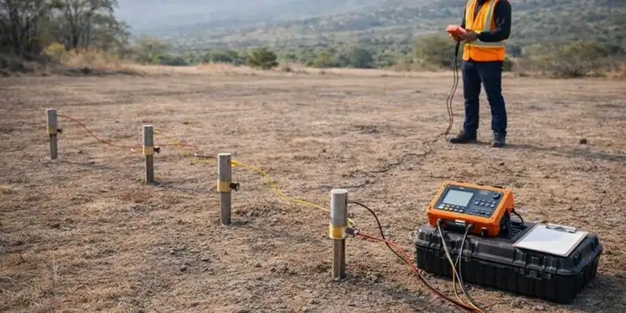
This suite of services is indispensable for a wide range of projects across the Baltimore metropolitan area. Major infrastructure initiatives, such as bridge rehabilitations, tunnel alignments, and the redevelopment of waterfront properties, depend on seismic tomography to create detailed 2D and 3D models of subsurface stiffness. Environmental due diligence for brownfield sites, common in former industrial zones like Canton, often requires electrical resistivity / VES to map contaminant plumes and monitor groundwater, as variations in pore fluid chemistry directly affect the measured resistivity. From pre-construction site characterization for high-rise developments in the Inner Harbor to forensic investigation of failing historic retaining walls, geophysics provides the critical data layer that minimizes risk and informs sound engineering decisions.
Common questions
What is the main purpose of a geophysical survey for a construction project in Baltimore?
The main purpose is to non-invasively characterize subsurface conditions to reduce the risk of unforeseen ground problems. In Baltimore, where conditions shift dramatically from shallow rock to deep sediments across the Fall Line, a survey identifies bedrock depth, soil layering, voids, and buried structures. This information is critical for foundation design, excavation planning, and complying with the seismic site classification requirements of the Baltimore City Building Code.
How are geophysical methods used to determine the seismic site class under the IBC in Baltimore?
The International Building Code (IBC) requires determining a site's seismic class based on the average shear wave velocity in the top 30 meters (Vs30). The most common geophysical method to measure this is Multichannel Analysis of Surface Waves (MASW). An MASW survey provides a direct, non-invasive measurement of Vs30, which dictates the seismic design forces for a structure, directly impacting structural costs and safety.
Can geophysics locate buried utilities and underground storage tanks on a redevelopment site in the city?
Yes, this is a primary application. Ground Penetrating Radar (GPR) is the standard high-resolution method for locating metallic and non-metallic utilities, former foundations, and underground storage tanks (USTs) in urban fill. For mapping the extent of contaminant plumes from a leaking UST, electrical resistivity imaging is often used to delineate the affected soil and groundwater volume by measuring changes in subsurface electrical properties.
What are the limitations of a geophysical survey in an urban environment like downtown Baltimore?
Urban environments present significant challenges including cultural noise from traffic and power lines, limited access due to buildings and pavement, and complex subsurface conditions with multiple utility lines. These factors can interfere with seismic and electromagnetic signals. A successful survey requires careful method selection and experienced data processing to filter out noise. No single method is perfect, so a combination of techniques is often necessary to provide reliable results.