Road geotechnics in Baltimore forms the critical foundation of every transportation infrastructure project, encompassing the engineering behavior of soil and rock beneath pavements, embankments, and drainage systems. This specialized discipline addresses the unique challenge of constructing durable roads atop the complex geological formations of the Chesapeake Bay watershed, where variable soil conditions can undermine even the most meticulously designed surface courses. Without rigorous subsurface investigation and tailored geotechnical solutions, Baltimore's highways, arterial roads, and local streets would face premature failure from differential settlement, frost heave, and moisture-induced weakening of the subgrade.
Baltimore's geological profile presents a distinctive set of conditions that demand expert geotechnical attention. The city straddles the Fall Line, the boundary between the resistant crystalline rocks of the Piedmont Plateau to the west and the soft, compressible sediments of the Atlantic Coastal Plain to the east. This transition zone yields highly variable subsurface materials within short distances: residual silts and clays derived from weathered schist and gneiss in the western neighborhoods, juxtaposed with thick deposits of alluvial sands, silts, and organic clays along the Patapsco River and Inner Harbor areas. The presence of high groundwater tables, particularly in low-lying reclaimed waterfront zones, further complicates road construction by reducing soil bearing capacity and increasing the risk of pumping failures under repeated traffic loads.
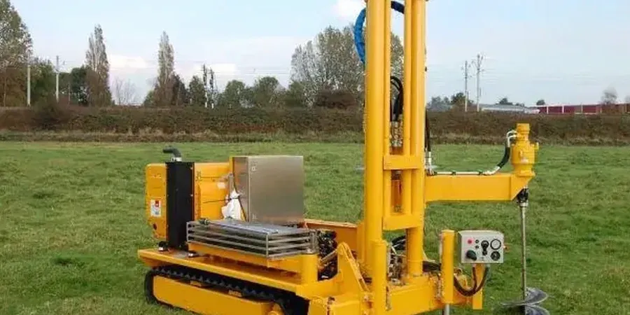
All road geotechnical work in Baltimore must conform to the stringent standards established by the Maryland Department of Transportation State Highway Administration (MDOT SHA), which adopts and adapts the AASHTO LRFD Bridge Design Specifications and the AASHTO Guide for Design of Pavement Structures. The MDOT SHA Standard Specifications for Construction and Materials dictate the acceptable methods for subgrade preparation, compaction, and stabilization. For federally funded projects, compliance with FHWA regulations on geotechnical site characterization and foundation design is mandatory. These frameworks require thorough geotechnical investigations—including Standard Penetration Tests (SPT), Cone Penetration Tests (CPT), and laboratory resilient modulus testing—to classify soils per the AASHTO system and determine design parameters like the California Bearing Ratio (CBR) for flexible pavement design.
The scope of road geotechnics in Baltimore extends across a wide array of project types. Major interstate widening and rehabilitation, such as ongoing work on I-95 and the Baltimore Beltway (I-695), requires comprehensive existing pavement evaluation to assess remaining structural life and identify subgrade failure zones. New residential and commercial developments in the outlying counties demand robust road embankment design to ensure stable slopes and controlled settlement over compressible alluvial deposits. Urban revitalization projects in neighborhoods like Port Covington and Harbor East, built on former industrial land and artificial fill, necessitate specialized geotechnical road drainage strategies to intercept groundwater and prevent the capillary rise that can saturate and weaken pavement foundation layers. Even routine resurfacing contracts benefit from a fundamental understanding of pavement/subgrade design principles to avoid repeating historical distress patterns.
Common questions
What is road geotechnics and why is it essential for Baltimore infrastructure projects?
Road geotechnics is the branch of civil engineering that focuses on the behavior of earth materials—soil, rock, and groundwater—as they relate to the structural support, stability, and drainage of roadways. In Baltimore, it is essential because the city's location on the Fall Line creates highly variable subsurface conditions, from crystalline rock to soft coastal plain sediments, that directly control pavement longevity and embankment safety.
How do local geological conditions affect the geotechnical design of roads in Baltimore?
Baltimore's geology transitions sharply between the Piedmont's residual silty clays and the Coastal Plain's compressible sands and organic deposits. High groundwater in reclaimed harbor areas weakens subgrade strength. These conditions require site-specific design measures such as chemical stabilization of moisture-sensitive soils, deep foundations for embankments over soft clays, and robust drainage to control seepage and prevent frost-related damage.
What are the primary geotechnical risks that lead to pavement failure in the Baltimore region?
The primary geotechnical risks include differential settlement where fills transition to cut sections, subgrade softening from poor drainage in the high-water-table Coastal Plain, and frost heave during winter cycles in moisture-susceptible silts. Inadequate compaction of urban fill materials and the presence of undocumented underground structures in older city neighborhoods also contribute to localized pavement distress and pothole formation.
Which regulatory standards govern geotechnical investigations for Maryland road projects?
Geotechnical investigations for Maryland road projects are governed by MDOT SHA's Standard Specifications and the AASHTO LRFD design framework, supplemented by FHWA guidelines for federal-aid projects. These standards mandate minimum boring depths, laboratory testing protocols for soil classification and resilient modulus, and specific design methodologies for subgrade treatment, slope stability analysis, and pavement structural number calculation.